2024
Radar system for tracking invasive insects
Principal Investigator (PI): Norman Leppla (EN)
Co-Investigators (Co-Is): Tan Wong (ECE), Jasmeet Judge (ABE), Isaac Esquivel (EN), Marcelo Wallau (AGR).
Funded by the UF Invasion Science Research Institute.
The project combines novel remote sensing technology with AI algorithms to significantly improve our ability to track new invasive insect species to detect and eradicate populations before they reproduce and spread. Such tracking is critical for understanding movement and behavior, leading to effective intervention.
EN: Entomology and Nematology; ECE: Electrical and Computer Engineering; ABE: Agricultural and Biological Engineering; AGR: Agronomy
Integrating socio-economic and remotely sensed information to characterize conflict precursors and land degradation dynamics in Ghana
Principal Investigator (PI): Aditya Singh (ABE)
Co-Investigators (Co-Is): Jasmeet Judge (ABE), Changjie Chen (DCP), Samuel Annim (GSS), Foster Mensah (CERSGIS), Greg Kiker (ABE), Walther Olivier (GEOG).
Funded by the NASA-USAID SERVIR Program.
The project combines high-resolution remote sensing from drones with socioeconomic and geospatial datasets for mapping land degradation and providing an operational framework for resolving land-utilization conflicts in the greater West African region. This project will also help to build technical capacity using AI-based remote sensing and open-source GIS tools by conducting training workshops for the stakeholders in the Environmental Protection Agency in Ghana.
ABE: Agricultural and Biological Engineering; DCP: College of Design, Construction and Planning; GSS: Ghana Statistical Service; CERSGIS: Center for Remote Sensing and Geographical Information Services, Ghana; GEOG: Geography
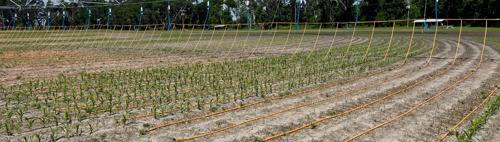
Enhancing the irrigation management in vegetable farms in Southeast U.S. by developing root zone soil moisture maps in both high spatial and temporal resolutions
Principal Investigator (PI): Ziwen Yu (ABE)
Co-Investigators (Co-Is): Sandra Guzman (ABE), Jasmeet Judge (ABE), William Lusher (FAWN), George Vellidis (UGA), Andre da Silva (AU), Pam Knox (UGWN).
Funded by the USDA-NRCS CIG Program.
The project combines satellite remote sensing and in situ farm data to develop an AI-based rapid and efficient method to enhance irrigation planning and provide near-real-time root zone soil moisture in vegetable crops in Florida and Georgia. Such timely and comprehensive information on irrigation stress is critical for crop producers.
ABE: Agricultural and Biological Engineering; FAWN: Florida Automated Weather Network; UGA: University of Georgia; AU: Auburn University; UGAWN: University of Georgia Weather Network
Linking deforestation, urbanization, and agricultural expansion for land-use decisions in Ghana
Principal Investigator (PI): Jasmeet Judge (ABE)
Co-Investigators (Co-Is): Aditya Singh (ABE), Changjie Chen (DCP), Foster Mensah (CERSGIS), Greg Kiker (ABE), Walther Olivier (GEOG).
Funded by the NASA-USAID SERVIR Program.
This project combines publicly available satellite remote sensing, geospatial datasets, and open-source GIS tools to develop an operational framework to identify land suitability conflicts and generate future land use scenarios for land use planners. The Global Land Use Project (GALUP) started in Ghana and has been expanded to human-wildlife conflicts in Botswana. The land-use planners in the region are trained in the framework and in remote sensing and open-source GIS tools to build capacity in the region. The training materials are available freely on the GitHub repository.
ABE: Agricultural and Biological Engineering; DCP: College of Design, Construction and Planning; CERSGIS: Center for Remote Sensing and Geographical Information Services, Ghana; GEOG: Geography
Integrating NASA earth system data into decision-making tools of member utilities of the Florida Water and Climate Alliance
Principal Investigator (PI): Chris Martinez (ABE)
Co-Investigators (Co-Is): Tirusew Asefa (TampaBay Water), Tracy Irani (FYCS), Jasmeet Judge (ABE), Vasu Misra (FSU).
Funded by the NASA-ASP Water Resources.
The project combines hydrology model forecasts with high-resolution seasonal climate forecasts from NASA satellite and model-based products to improve water allocation and storage decisions by public water utilities in Florida. These forecasts are integrated into the decision-support tools used by the water utilities.
ABE: Agricultural and Biological Engineering; FYCS: Family, Youth, and Community Sciences; FSU: Florida State University
Fusion of multiscale remote sensing data to disaggregate microwave observations using scalable machine learning techniques
Principal Investigator (PI): Jasmeet Judge (ABE)
Co-Investigators (Co-Is): Anand Rangarajan (CISE), Sanjay Ranka (CISE).
Funded by the UF Informatics Institute NASA THP.
This project uses AI/ML algorithms to provide high-resolution information on soil and crop conditions from coarse-resolution microwave observations from satellites.
ABE: Agricultural and Biological Engineering; CISE: Department of Computer and Information Science and Engineering
Geoscience engagement and outreach (GEO) – High impact integrated academic and professional experience
Principal Investigator (PI): Heidi Lannon (SFC)
Co-Investigators (Co-Is): Kati Stofer (AEC), Jasmeet Judge (ABE), Corene Matyas (GEOG), Brandon Lanman (OSC).
Funded by the NSF-IUSE Program.
This tri-institutional partnership among a community college, research university, and science center provides integrated academic, research, and hands-on outreach experiences in geosciences for community college students. This year-round program is immersive to increase student recruitment, retention, and transfer from a two-year associate's program to a bachelor's program in geosciences.
SFC: Santa Fe College; AEC: Department of Agricultural Education and Communication; ABE: Agricultural and Biological Engineering; GEOG: Geography; OSC: Orlando Science Center