Modification of Hydrological Patterns
by the Everglades Restoration Processes
Flooding and drought conditions have intensified in south Florida during the past few years. Due to the very high permeability of the soil, these extreme water scenarios can often be linked both to water levels in canals surrounding the area and to severe meteorological conditions.
The physical conditions of the coral-based media (soil and limestone bedrock) permit very fast groundwater flow under wet conditions. Resulting changes in canal levels in turn translate quickly to changes in water table levels in the field, which can have devastating effects on crops.
However, visible flooding is not the only problem facing agricultural management in south Florida. It is well known that surface water levels can contribute to the water budget in the root zone (or vadose zone), thus affecting crop viability. Upward flow of water (capillary movement) affects soil moisture content levels and can influence crops either beneficially or adversely, depending on specific water demands, flood- and anaerobic-tolerance and root susceptibility to diseases.

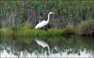
L-31W canal at the eastern boundary of Everglades National Park.
TREC's hydrology team has set up a 5000-acre demonstration watershed on the eastern boundary of Everglades National Park. This demo area includes a distributed monitoring network with fourteen wells fully instrumented for water elevation and water quality sampling, two rain gauges, four canal and drainage ditch stage recorders, soil moisture sensors, and an automatic weather station.

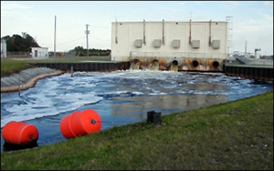
Pumping station in the C-111 canal next to Everglades National Park.
Records of all water inputs and outputs are obtained every 15 minutes, and surface and ground water quality samples are collected at 18 different locations biweekly. The data are being utilized to study the hydrology of the area and to assess the impact of the 1000-acre CERP detention pond that is being constructed in the area. This demonstration project is providing valuable information to those who make regional water management decisions.

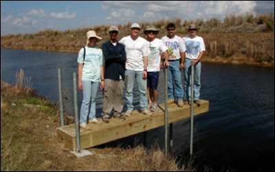
Installation of a canal platform for water quality sampling and automatic water stage logging.
An advanced online information system (UF-HydroBase) has been developed to analyze hydrology and water quality data.
The following slide presentations give details about this ongoing project (requires Adobe Reader to view .pdf documents; advance presentation using Page Down/Up keys; exit with Escape key):
- UF Frog Pond Hydrology Network: Monitoring Groundwater Flow and Water Quality Along the Eastern Boundary of Everglades National Park[520KB]
- Frog Pond Geographical Information System[812KB]
- UF-HydroBase[512KB]
This page was last updated on July 13, 2019.